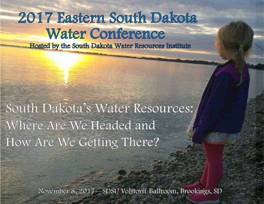
Nov. 8, 2017
The Eastern South Dakota Water Conference is held on the campus of South Dakota State University and attracts attendees from academia, students, local, state and federal agencies, among others. Water is an environmental good that provides critical services for recreation, economic development, agricultural and domestic use; all of which are important to human activity. Join us for a discussion on the current status of our water resources in eastern South Dakota and participate in the development of a cooperative action plan aimed at improving and protecting them.
Agenda
Water is an environmental good that provides critical services for recreation, economic development, agricultural and domestic use; all important to human activity. The morning portion of the conference will be a series of speakers discussing the current status of our water resources in eastern South Dakota. The afternoon sessions will be used to discuss concerns and needs for studying and protecting our water resources. A white paper will be developed from these discussions.
Many people have contributed to this conference. The Organizing Committee would like to thank presenters, judges, moderators and the other volunteers who helped make the conference a success.
The South Dakota Water Resources Institute (WRI) at South Dakota State University provides leadership on evolving water concerns and problems being faced by South Dakota citizens through research, educational opportunities for students and professionals and community outreach.
The Institute is a federal-state partnership that:
- Plans, facilitates and conducts research to aid in the resolution of State and regional water problems.
- Provides for the training and education of scientists and engineers through their participation in research and outreach.
- Promotes technology transfer and the dissemination and application of water-related information.
- Provides for competitive grants for students and researchers.
Authorized by Congress as one of the nation’s 54 water resources research institutes, we also connect the research expertise at South Dakota State University to water-related problems at the local, regional or national level. The Institute is affiliated with the University’s College of Agriculture and Biological Sciences, Department of Agricultural and Biosystems Engineering and the South Dakota Agricultural Experiment Station.
8 a.m.
Registration Begins
8:30–8:45 a.m.
Opening Remarks by William Gibbons.
Interim Associate Director, South Dakota Agricultural Experiment Station/Associate Dean for Research.
Room 101B
8:45–9:15 a.m.
Shannon Minerich, South Dakota Department of Environment and Natural Resources.
An Overview of South Dakota’s Integrated Report.
Room 101B
9:15–9:45 a.m.
Alan Wittmus, South Dakota Department of Environment and Natural Resources.
Surface Water Quality Monitoring in South Dakota.
Room 101B
9:45–10:15 a.m.
Derric Iles, State Geologist, South Dakota DENR.
The Quality of Water in Surficial Glacial Outwash as Documented in South Dakota’s Statewide Ground Water Quality Monitoring Network. Room 101B
10:15–10:45 a.m.
Break / Poster Presentation Competition (Room 101A)
10:45–11:45 a.m.
Concurrent Session 1 Room 101B
Concurrent Session 2 Room 101A
11:45 a.m. – 1 p.m.
Lunch and Networking (Room 101A)
12:15–1 p.m.
Luncheon Speaker, Rebecca Perrin, EPA Region 8 Agriculture Advisor.
Success Stories - The Importance of Stakeholders in Water Quality Protection.
Room 101A
1–3 p.m.
Roundtable Discussion Room 101A
3–3:30 p.m.
Roundtable Discussion Summary Room 101A
Keynote Speaker
Rebecca Perrin
Rebecca Perrin has served as the Agriculture Advisor for Region 8 since 2012. In this capacity, she serves as a liaison between the agricultural community and the Region, and provides advice on agricultural environmental programs and policies. Prior to becoming the Regional Agriculture Advisor, Rebecca worked in the EPA Region 8’s Tribal Assistance Program. Before joining EPA, Rebecca worked for an affiliate of Enterprise Rent-a-Car for more than six years, doing liability and risk management related work. Rebecca obtained a Bachelor of Science in soil and crop science from Colorado State University and a Master of Applied Science in environmental policy and management from the University of Denver. Outside of work, Rebecca is a new mom to a happy, healthy and curious almost 1 year old baby boy.
Plenary Speakers

Shannon Minerich
Shannon Minerich is an environmental scientist with the South Dakota Department of Environment and Natural Resources. Her work with the department includes the state’s Integrated Report, mercury in fish tissue, department quality control and fieldwork for the Surface Water Quality Program. Shannon received a Bachelor of Science degree in biology with a minor in chemistry from the University of North Dakota. All of Shannon’s remaining time is consumed working on the family cattle ranch in the badlands of North Dakota with her husband and their 2-year-old daughter.

Alan Wittmuss
Alan Wittmuss has worked for the South Dakota DENR for 25 years in the Watershed Protection Program. His focus is on clean lakes, water quality monitoring and non-point source implementation projects. Alan earned a B.S. (1992) and M.A. (1996) in biology/aquatic ecology, both from the University of South Dakota.

Derric Iles
Derric Iles is the South Dakota State Geologist and administrator of the Geological Survey Program, Department of Environment and Natural Resources. His primary functions are the planning and directing of the Geological Survey’s activities that locate, describe, map and evaluate the natural resources of South Dakota. He has worked for the Geological Survey for 39 years, beginning in 1977, and has served as State Geologist for nearly 20 years. He also worked as a senior hydrogeologist/project manager for Soil Exploration Company/Twin City Testing Corporation/Huntingdon Engineering and Environmental Inc. in St. Paul, Minnesota, in the 1984-1986 time period. Much of his work has been related to South Dakota’s ground-water resources. Derric earned a B.A. in geology in 1975 from the University of Northern Iowa and a M.S. in geology in 1977 from Iowa State University.
Poster Presentations
Poster 1 - FM Area Diversion Project
Greg Thompson, PE, with Houston Engineering, Inc.
The FM Area Diversion Project is a $2.2 billion, 30-mile long diversion channel and 150,000 ac-ft dam that provides flood protection to the Fargo-Moorhead Metropolitan area. To ensure that the project operates as designed, a significant hydrologic and hydraulic modeling effort was undertaken. Hydraulic engineers from the Houston-Moore Group—primarily composed of Houston Engineering, Inc. and Moore Engineering, Inc.—developed the hydraulic models in close conjunction with the U.S. Army Corps of Engineers and the local sponsors. Hydrology was developed for the Red River main stem and its tributaries adjacent to the project. The hydraulic model, encompassing over 3,000 river cross sections, extended upstream to the South Dakota/North Dakota border to accommodate unique inflow hydrology characteristics, and it was extended downstream to the North Dakota/Canadian border to define impacts downstream of the project.
Poster 2 - Riverfront Renaissance 2nd Street/Downtown Fargo Floodwalls
Randy Engelstad, PE, with Houston Engineering, Inc.
Floods have had a significant impact on residents in the Upper Midwest in recent years. In some cases, river levels exceeded established protection levels and caused devastation within the communities. The City of Fargo has narrowly avoided the same devastation by constructing miles of emergency levees. While these emergency measures protected the community at the time, they are not reliable for flood protection. Fighting floods is a costly and time-consuming effort. The repetitive act of constructing emergency levees every decade since the 1960s has taken a toll on the City and its residents. The City needed a lasting and permanent flood protection solution. The ongoing F-M Diversion Project being planned and constructed through the F-M Diversion Authority (FMDA) and the US Army Corps of Engineers (USACE) is a means of providing long-term regional flood protection. Until the F-M Diversion is complete— and during larger flood events even after it is complete—permanent flood protection is needed for the 2nd Street/Downtown area. This area is the home to City Hall, historic buildings, established businesses and residents. To achieve this, the City and the FMDA chose to construct a floodwall as a permanent line of protection between the City’s iconic downtown and the flood-prone Red River. The floodwall stretching for approximately 1,740 feet with a maximum height of 11 feet and averaging at 8 feet will significantly reduce the need for emergency levees during flood events. The project included realigning 2nd Street to the west to accommodate construction of a floodwall, which included the acquisition of several commercial properties. Houston Engineering was responsible for overall preliminary plan development as well as coordination of private utilities, design coordination and overseeing construction. In the end, this floodwall project provides permanent and reliable flood protection to a heavily populated and commercial area.
Poster 3 - i-DST: An Integrated Decision Support Tool for Stormwater Management
Ali Shoajeizadeh 1, Mengistu Geza Nisrani 1, Colin Bell 2, Terri Hogue 2, John McCray 2
1 South Dakota School of Mines and Technology
2 Colorado School of Mines
Stormwater management requires selection of Best Management Practices (BMPs) appropriate for the site and optimizing the design and cost of BMP infrastructure. Creating the balance between grey and green infrastructure has been recognized as a viable approach to address the economic, environmental, social and technical challenges. A Visual Basic Application (VBA) based integrated Decision Support Tool (iDST) was developed to select the BMPs. i-DST is user-friendly tool; selects and optimizes BMPs base on stormwater water quality, runoff reduction, treatment efficiency and cost. The tool integrates comprehensive national BMP water quality database, several types of BMPs ranging from conventional to current green infrastructure technologies and treatment efficiencies, capital cost and Life Cycle Cost Assessment (LCCA). The i-DST is intended to help designers, utilities, regulators and municipalities to evaluate stormwater management options considering economic, environmental, technical and social factors. The i-DST input data includes water quality input, target water quality requirements, costs and flows. The development of i-DST started with the establishment of a comprehensive water quality and quantity database. The i-DST selects most effective BMPs (or a BMP) with respect to technical and economic criteria that could meet the target water quality and flow reduction requirements. The i-DST is a flexible tool allowing users to change weights to BMP selection criteria. Users can also limit the type of BMPs to be included in the selection process to those that are applicable to their site. For existing infrastructure, users can apply i-DST to determine if additional BMPs are needed to meet target water quality or runoff reduction requirements. It was demonstrated through scenario evaluation that the tool recommended cost-effective BMPs capable of producing the water quality and flow reduction required for given site-specific conditions and water quality.
Poster 4 - The Development of travel time equation for overland flow
Naga Vara Prasad Ganti (M.S) and Dr. Suzette Burckhard, Department of Civil and Environmental Engineering, SDSU
In overland flow research, it is generally understood that overland flow is assumed to be in turbulent condition in order to estimate travel time using Manning’s Velocity Equation (MVE). The Grimmer mean velocity equation is applied but fails to consider the roughness parameter, when flow is in the laminar condition. The literature includes equations for overland travel time, but there is no known equation to determine mean velocity of overland flow under laminar condition that includes the roughness variable. A new overland flow travel time equation was developed by assuming that flow is laminar with Chezy’s roughness coefficient. Relationships were established between Grimmer’s laminar Mean Velocity Equation and Chezy’s roughness coefficient. The new equation was tested on theoretical models for bare soil, corn and Bermuda grass. Major findings were that there is a significant difference in travel time using the newly developed equation in comparison to existing travel time equations. Even assuming that flow is turbulent, results indicated that flow is mostly laminar when theoretically testing bare soil, corn and Bermuda grass.
Poster 5 - Developing a Model to Study the Effects of Habitat Restoration and the Change in Habitat on Aquatic Life
Mackenzie Kenney; Civil and Environmental Engineering Department, SD School of Mines and Technology; Advisers: Dr. Stu Geza; Civil and Environmental Engineering Department, Dr. Scott Kenner; Civil and Environmental Engineering Department, SD School of Mines and Technology and Jake Davis; Game, Fish and Parks
For years, the Black Hills streams have been a primary habitat for salmonid fishery for wild brown trout (Salmo trutta), rainbow trout (Oncorhynchus mykiss) and brook trout (Salvelinus fontinalis). Recently, a steady decline in the brown trout population has been observed in Pactola Basin amongst fish ranging in size from 150mm to 250mm. A stretch of Rapid Creek has experienced high water flow releases from Pactola Reservoir which washed away banks and affected fish habitat. This resulted in increases velocity, erosion and subsequent reduction in hiding spots/spawning areas for brown trout and other fish. An extensive habitat project has been carried out by Game, Fish and Parks involving placing boulders across the stream bed and burying wind-fallen trees along the bank to encourage the productivity of trout fisheries in this section of Rapid Creek. A two-dimensional hydraulic model, River2D, will be used for hydraulic and habitat analysis on this Rapid Creek habitat restoration project. The post-construction stream characteristics will be modeled and compared to pre-construction stream characteristics to evaluate the effects of hydraulic parameters on stream habitat. The results from this research will be used to guide future habitat restoration by providing a more accurate estimate of how stream morphology will impact existing habitats within the Black Hills. Thus, the objectives for this project are; (1) Collect pre- and post-development stream cross-section data through surveying. (2) Create a pre- and post-development River2D model to analyze the effect of habitat restoration projects on hydraulic parameters such as velocities and water depth. (3) Identify data that has been collected on flows and fish distribution in space and time, and use this data to calibrate the models. (4) Assess the success of implemented habitat structures and their benefit to the streams habitat. (5) Use modeling results and filed observation to guide future fish habitat restoration projects.
Poster 6 - Nutrients, Pesticides and Selenium in Agricultural Tile Discharges into Public Wetlands, Madison Wetland Management District, South Dakota
Matthew S. Schwarz, Bryan Schultz (U.S. Fish and Wildlife Service). Drew R. Davis, Jacob L. Kerby (Department of Biology, University of South Dakota)
There are approximately 4.4 million acres of wetlands in the Prairie Pothole Region of the Dakotas that provide essential habitat for wildlife, improve water quality and provide flood control benefits. However, these wetlands are increasingly receiving discharges from agricultural tile drainage. We measured pollutants in tile effluent and evaluated water quality and habitat degradation at Waterfowl Production Areas managed by the U.S. Fish and Wildlife Service. Eighteen wetland sites were periodically sampled from 2011–2015. These sites were divided into three site categories of six wetland sites each: 1) “Tile Wetland” for wetland sites that directly receive tile outfall discharges but may also receive surface runoff of agricultural chemicals, 2) “Surface Wetland” for wetland sites that receive surface runoff of agricultural chemicals but have no known tile discharge inputs and 3) “Reference Wetland” for wetland sites that are well buffered from agricultural chemicals in surface runoff and receive no direct tile outfall discharges. Concentrations of nutrients, pesticides and selenium in tile effluent exceeded water quality benchmarks for the protection of aquatic life. There were also differences in pollutant concentrations between wetland site categories, with Tile Wetland sites having higher concentrations of select pesticides, nutrients and selenium than Reference Wetland sites. Tile Wetland sites also exhibited selenium bioaccumulation in wetland biota (plants, aquatic invertebrates and duck eggs) and had overall lower South Dakota Wetland Rapid Assessment Protocol scores. From the results of this study, we recommend actions to reduce agricultural pollutant discharges into public wetlands.
Poster 7 - Photodegradation of (E)- and (Z)-Endoxifen by UV Light: Performance, By-products and Toxicity Assessment
Marina Arino Martin, Jayaraman Sivaguru, and Eakalak Khan
Environmental and Conservation Sciences Program, North Dakota State University, Fargo, ND, Chemistry and Biochemistry Department, North Dakota State University, Fargo, ND, Civil and Environmental Engineering Department, North Dakota State University, Fargo, ND
Endoxifen is an effective metabolite of a commonly used chemotherapy agent, tamoxifen. Endoxifen has been detected in the final effluent of wastewater treatment plants (WWTPs). The release of endoxifen into the water environment could bring a negative effect to aquatic lives due to its antiestrogenic activity. This research investigates ultraviolet (UV) radiation (253.7 nm) application to degrade endoxifen in water and wastewater and the generation of phototransformation by-products (PBPs) and their toxicity. The effects of light intensity, pH and initial concentration of (E)- and (Z)- endoxifen on the photodegradation rates were also investigated. Endoxifen was eliminated from water by at least 99.1% after 35 seconds of irradiation (light dose of 598.5 mJ cm-2). Light intensity and initial concentration of (E)- and (Z)-endoxifen exhibited positive linear correlations with the photodegradation rates while pH had no effect. Photodegradation of (E)- and (Z)-endoxifen in water results in three PBPs. Toxicity assessments through modeling of the identified PBPs suggest higher toxicity than the parent compounds. Photodegradation of (E)- and (Z)-endoxifen in wastewater at light doses used for disinfection in WWTPs resulted in reduction of (E)- and (Z)endoxifen by at least 30, 44, and 71% at the light doses of 16, 30 and 97 mJ cm-2, respectively. Two of the three PBPs observed in the experiments with water were detected in the experiments in wastewater. Therefore, highly toxic compounds are potentially generated at WWTPs during UV disinfection process if (E)- and (Z)endoxifen are present in the treated wastewater. Key Words— Endoxifen, photodegradation, photodegradation by-products, toxicity assessment.
Poster 8 - Photocatalytic Degradation of Disinfection Byproducts Using Natural Sunlight and TiO2
Ibrahim Abusallout and Guanghui Hua, SDSU
Reuse of municipal wastewater effluent to augment drinking water supplies is one of the solutions to achieve a sustainable use of water. However, water reuse practices have drawn serious concerns regarding contaminants in treated effluents. The addition of chlorine to wastewater effluent for disinfection purposes can lead to the formation of disinfection byproducts (DBPs) such as trihalomethanes, haloacetic acids and total organic halogen (TOX). Additionally, wastewater effluents typically have high levels of iodide and bromide ions, which lead to the formation of highly toxic iodinated and brominated DBPs. This has raised concerns about the potential impact of DBPs in the treated effluent on public health during water reuse. Solar photocatalysis based upon titanium dioxide (TiO2) has emerged as a promising energy-efficient process for degradation of a variety of toxic organic compounds present in wastewater. The primary objective of this research was to investigate the photocatalytic degradation of DBPs in aqueous suspension of TiO2 with natural solar irradiation. In this study, we used outdoor photolysis experiments to investigate the degradation of total organic chlorine (TOCl), bromine (TOBr) and iodine (TOI) by solar-TiO2 photocatalysis. Suwannee River fulvic acid (SRFA) was used as DBP precursor to react with chlorine, bromine and iodine to produce desired levels of TOCl, TOBr and TOI. A series of experiments were carried out to assess the factors that can affect the performance of TiO2 photocatalysis under natural sunlight irradiation for TOX degradation. A range of time, pH, TiO2 type and dose and natural organic matter (NOM) were selected during the outdoor photolysis experiments to simulate typical wastewater treatment conditions. The results of this study help determine the applicability of solar-TiO2 photocatalytic process for reducing the health risks associated with toxic DBPs during water reuse.
Poster 9 - A Comparative Study of Heterogeneity Characterization for Contaminant Migration in the Madison Aquifer, near Rapid City Area
Thomas Stasiak 1, Liangping Li 2
1 Undergraduate, Department of Geology and Geological Engineering, South Dakota School of Mines and Technology
2 Assistant Professor, Department of Geology and Geological Engineering, South Dakota School of Mines and Technology
Groundwater is the major drinking water resource in South Dakota, and more than 90 percent of the population relies on groundwater. In particular, the Madison aquifer is the main water resources for the Rapid City. The groundwater quality, therefore, plays an indispensable role in the safety of drinking water and human health. The Madison aquifer is karstic and highly permeable with strong heterogeneity because of the development of caves, conduits, and fractures. Thus, contaminants such as microbes from the recharge zone of the Madison aquifer in the Black Hills (e.g., Boxelder Creek) could travel swiftly through the aquifer and reach to pumping wells for the drinking water. While there is some knowledge of contaminant sources for the groundwater in the Madison aquifer, there is little understanding as to the contaminant flow paths and the potential risk to the human beings, especially for the Rapid City area. The contaminant migration path strongly depends on the characterization of Karst aquifer (e.g., connectivity). In this work, zoned conductivity, simple Kriging and multiple-points geostatistics methods are used to characterize the heterogeneity of the Madison aquifer and compared in terms of the contaminant migration. The dye test conducted in Boxelder Creek is used to validate the characterization. The results show that the multiple-point geostatistics can be used to characterize the heterogeneity in the Karst and well reproduces the results of dye tests, while the zoned characterization and simple Kriging methods underestimate the travel times of contaminants.
Poster 10 - Modeling Nitrogen Fate and Transport from On-site Septic Systems in Black Hills, South Dakota
Raul Vasquez; Civil and Environmental Engineering Department, SD School of Mines and Technology Mentor/Advisor: Dr. Stu Geza; Civil and Environmental Engineering Department, SD School of Mines and Technology
The Black Hills area has over 10,000 on-site septic systems, many located in karst limestone and alluvial sediments. The permissibility of these formations in combination with high water tables presents potential for contamination of groundwater. Wastewater constituents of concern from septic systems include nitrogen, phosphorus, viruses and bacteria. Nitrate-Nitrogen will be the focus of this project given its longer residence times within soils and its ability to travel with water. The heightened levels of nitrogen in correlation to the location of clustered systems in the area increases groundwater contamination concerns. Conventional on-site septic system construction is not necessarily compatible with every hydrological setting in the focus area, for this reason modeling is being used to determine contamination potential from wells in vulnerable areas. The use of modeling allows prediction of effects of leach fields on public health and environmental quality under various operating and site conditions. Unsaturated zone contaminant fate and transport models that are applicable include Hydrus 2D and a simplified soil treatment unit model (STUMOD). The modeling approach is supported by field data and a lab column experiment. The column experiment will be conducted to improve the prediction of nitrogen fate and transport from soil based systems and improve prediction of hydraulic parameters. Results under different operating and site conditions will be presented.
Poster 11 - Exploring Land Surface Dynamics in Eastern South Dakota using Passive Microwave Data
Woubet G. Alemu and Geoffrey M. Henebry, Geospatial Sciences Center of Excellence, SDSU
Passive microwave image products can offer views of moisture condition of the land surface at fine temporal (twice daily) but coarse spatial (25 km). We have characterized land surface and atmospheric moisture dynamics across Eastern South Dakota using the Advanced Microwave Scanning Radiometer (AMSR) enhanced land surface parameters for the recurring period for April through October for 2003 through 2017. Available variables included air temperature (t), precipitable water vapor (V), fractional water coverage (fw), volumetric soil moisture (vsm) and vegetation optical depth (VOD). Tracking fw as function cumulative precipitable water vapor-days (CVD) revealed distinct seasonalities in wet versus dry years. The dynamics of vsm clearly shifted from precipitation to evapotranspiration regimes during the growing season. Cropland dominated sites were wetter than grassland dominated sites. The years 2003, 2006 and 2012 were more dry, while 2009, 2010, 2011 and 2013 were more wet. We explored the changing crop fractions within the AMSR pixels using the USDA’s Cropland Data Layer. In crop-dominated sites the VOD time series caught the early spring flush, ploughing, and crop growth dynamics. In contrast, the VOD series at grass-dominated sites exhibited a distinct temporal pattern throughout the non-frozen season. There was significant interannual variation and the effect of drought was evident in the shape of the VOD and fw time series. The growing season GDD, V and VOD time series could be well fitted simple quadratic curves suggesting some predictive power.
Poster 12 - Evaluation of Woodchip Bioreactor Denitrification Kinetics
Abdoul Aziz Kouanda: MS Graduate Student, Department of Civil and Environmental Engineering, SDSU; Adviser: Dr. Guanghui Hua
Agricultural subsurface drainage is a water management practice used to remove excess water in poorly drained soil. The use of fertilizers combined with subsurface drainage practice affects negatively surface water quality due to nitrate loss. Woodchip bioreactors have been used as a method for removing nitrate from agricultural tile drainage. Understanding the mechanism that governs nitrate removal in woodchips bioreactor is crucial for field bioreactor design. The objective of this project is to determine woodchip bioreactor denitrification kinetics parameters under different temperatures. The impact of hydraulic retention time (HRT) was also briefly studied in this project. Column experiment was conducted with influent nitrate concentrations varying from 50 mg N/L to 3 mg N/L at a HRT of 12 hours. The integrated Michaelis Menten equation was used to determine the denitrification kinetics parameters. The half saturation constant was found to be 2.17 mg N/L and the maximum removal rate was 0.86 mg N/L/H at 22 degree Celsius. At 5 degree Celsius, we had a half saturation of 0.58 mg N/L and a maximum removal rate of 0.045 mg /L/H. At HRTs of 24 hours and 6 hours with influent nitrate concentration of 10 mg N/L, a 98.70 % and 29.4 % percentage removal was achieved respectively. The results of this study brought a significant contribution in better understanding denitrification kinetics in Woodchip bioreactor.
Poster 13 - Impacts of Land Use and Land Cover Change on Water Quality in the Big Sioux River: 2007-2015
Dinesh Shrestha, Department of Geography, SDSU; Adviser: Dr. Darrell Napton
The increased demands on ethanol and rises in the price of corn led to increment of corn acreage in South Dakota. Other driving forces such as crop insurance subsidies and disaster payments encouraged farmers to (1) convert pasture, fallow and grassland to corn acreage and (2) shift from other crops such as wheat to corn. The increment on corn acreage and adjustments in crop rotation between corn and soybeans resulted in use of increased amount of industrial fertilizers. The excess nitrate runoff from agricultural land—that the crops could not completely consume, leach into the Big Sioux River. The river transports the nitrates downstream leading to an increased nitrogen from the headwaters to the lower basin. Nitrate increases in the river may be associated with increased areas and intensities of agriculture in the watershed. High concentrations (10 ppm) are associated with human health issues and are regulated by the United States Environmental Protection Agency (EPA). This research focuses on determining the extent to which the nitrogen compounds are present in the Big Sioux River, especially brought by the nitrogen leaching from corn cropland. The research uses the National Agricultural Statistic Service (NASS) Cropland Data Layer (CDL) to characterize and determine the rates of land use land cover (LULC) change, uses Soil and Water Assessment Tool (SWAT) model in ArcGIS to calibrate and validate nitrogen data from East Dakota Water Development District (EDWDD) and analyze the temporal and spatial trend of nitrogen levels, and determine whether there is a correlation between LULC change and changes in nitrogen levels in the Big Sioux River.
Poster 14 - Bioinspired Materials for the Development of Renewable Water Treatment Technologies
Most-Farzana Yesmin 1, Uday Mishra 1, Laurent Ahiablame 2, Srinivas Janaswamy 1
1 Department of Dairy and Food Science, SDSU
2 Agricultural and Biosystems Engineering, SDSU
The presence excess nutrients in agricultural water generally leads to algal blooms and hypoxia. Low cost and renewable water treatment technologies are helpful to remove contaminants from agricultural water and conserve water quality. This study is aimed at investigating the feasibility of food-grade biopolymers to remove nitrate and phosphate from surface and sub-surface drainage water. Porous beads based on food grade polysaccharides iota-carrageenan and alginate were prepared and used as nutrient adsorption media. Since the charge groups of iota-carrageenan and alginate namely sulfate groups (SO3-) and carboxylate groups (COO-), respectively, interact well with nitrate and phosphorus residues, the two selected polysaccharides will be able to effectively remove excess nutrient from agricultural water.
Poster 15 - Lab-scale Evaluation of Bioreactors for Fecal Bacteria Removal from Synthetic Subsurface Drainage Water
Md Sami Bin Shokrana 1, 5, Rachel McDaniel 2, 5, Guanghui Hua 3, 6, Laurent Ahiablame 4, 5
1 Graduate Research Assistant, 2 Assistant Professor, 3 Assistant Professor, 4 Assistant Professor
5 Department of Agricultural and Biosystems Engineering, SDSU
6 Department of Civil and Environmental Engineering, SDSU
Surface water bodies in the Midwest United States receive a great deal of excess nutrients (e.g. nitrate, phosphorus) from agricultural fields. Denitrifying bioreactors can be effective in removing excess nutrients from subsurface drainage systems. However, the role of bioreactors in the fate and transport of fecal bacteria through subsurface drainage is not well understood. This study aims at evaluating the performance of four lab scale bioreactors constructed with (i) woodchips, (ii) woodchips followed by steel shavings, (iii) mixed woodchips and biochar, and (iv) steel shavings in removing E. coli from synthetic subsurface drainage water. Preliminary data will be presented to show nutrient removal ability of each bioreactor design. The hypothesis in this study is that maximum bacterial removal will be attained with the mixed woodchip and biochar followed by woodchip only, woodchip followed by steel shaving and steel shaving only.
Poster 16 - Assessing the fate and transport of nonpoint source pollutants in roadside ditches
Alex R. Boger 1 (M.S. Student), Laurent M. Ahiablame 2, Department of Agricultural and Biosystems Engineering, SDSU and Dwayne L. Beck 3, Manager/ Professor, Dakota Lakes Research Farm, SDSU, Pierre, SD
Roadside ditches play an important role in water quality of downstream receiving water bodies. However, little information on the transport of pollutants in roadside ditches, leading to the need for understanding of water quality in these ditches. The objectives of this study are to (1) characterize pollution concentrations of shallow groundwater in roadside ditches; and (2) evaluate the impact of cool and warm season grasses on the fate and transport of pollutants in roadside ditch. Shallow groundwater sampling wells were installed at two experimental sites along highways in South Dakota and water grab samples were taken following major rainfall events. The samples were analyzed for a number of nonpoint source pollutants including dissolved phosphorous, nitrate, nitrite and selected metals (e.g. lead and copper). Results revealed large variability in measure pollutant levels in the experimental ditches, with a range of 0.01 to 12 mg/L for dissolved phosphorus, 0 to 2 mg/L for nitrate, and 0.1 to 104 µg/L for aluminum. Roadside ditches containing warm season grasses had significantly lower chloride concentrations than ditches with cool season grasses. There was no statistical significant differences in nitrogen, phosphorus, aluminum, copper, iron, manganese and zinc concentrations between ditches with warm and cool season grasses.
Poster 17 - Application of Controlled Drainage and Saturated Buffers Use for Conservation Drainage in South Dakota
Abhinav Sharma 1 (M.S. Student), Rachel McDaniel 2, and Todd Trooien 3, Department of Agricultural and Biosystems Engineering, SDSU, Brookings, SD
Nitrogen is an essential nutrient for crop growth; however, excess concentration of the nutrient can cause hypoxic conditions in waterbodies. Agricultural subsurface drainage is one pathway for nitrogen to enter surface waters. Conservation practices, including Drainage Water Management (DWM) and saturated buffers, have been implemented to assess their effectiveness for reducing nitrate in subsurface drainage water in South Dakota. DWM uses a control structure containing vertical boards to manipulate the water table depth throughout the cropping season. Water table is raised after planting, specifically during the plant growth stage, to aid water and nitrogen requirements of the crop. On the other hand, saturated buffers use a control structure to divert water to a perforated tile line buried parallel to a waterway. As the water filters through the soil, nitrogen and water are taken up by plants, thus reducing the amount delivered to the waterway. Two field-scale saturated buffers and two field-scale DWM sites were installed over the fall of 2015 and summer of 2016. Water samples were collected from the sites during flow conditions and analyzed for nitrate concentration. Preliminary results from June 2016 show that DWM reduced nitrate loads per acre by 3.5% as compared to conventional drainage. For the saturated buffer sites at Flandreau and Baltic, an array of wells were installed to assess the reduction of nitrate through the buffer. The preliminary results from Flandreau for 2016 show the saturated buffer reduces nitrate concentrations by 86.7% on average. Next steps include completing sample analyses and load calculations, setting up a SWAT project to simulate DWM and conventional drainage and compare the nitrate loading results for both the scenarios.
Poster 18 - Determination of Kinetic Parameter using Extant Respirometry
Eden Simon Heliso, Water and Environmental Engineering Research Center, SDSU; Adviser: Dr. Christopher Schmit
Biological systems are a major part of wastewater treatment. To maximize the performance of these biological systems, Environmental Engineers need to understand the mechanism of microorganisms in treating wastewater. In order to quantify and express the performance of microorganisms, kinetic parameters were developed. As wastewater systems are designed, accurate and applicable kinetic parameters are necessary to maximize the efficiency of the treatment plant. Therefore developing a cost and time effective way to estimate these parameters is important. Before refining these parameters used in designing treatment plants, verifying that the current wastewater characteristics are in fact described by the original parameters is essential. Therefore, extant respirometry was used to calculate these parameters on samples obtained from the Brookings Wastewater Treatment Plant. These parameters include the yield (Y), maximum specific substrate utilization rate (qm), maximum specific growth rate (µm) and the half saturation coefficient (Ks). Preliminary results show that the kinetic parameters fall within typical values. Future research will focus on estimating competent biomass as well as finding optimum operation conditions for the competent biomass.
Poster 19 - Escherichia coli removal from stormwater in steel chips filter: Effect of infiltration rate, Initial bacterial concentration, Particle size, pH, NOM and steady and intermittent flow
Peng Dai (M.S. Student), Department of Civil and Environmental Engineering, SDSU; Adviser: Guanghui Hua
Media filtration has received increasing attention as an effective technology that can facilitate the removal of particles and dissolved pollutants in stormwater. However, most traditional media filtration systems are generally ineffective in removing bacteria, causing pollution of groundwater and receiving surface water. Recent studies have shown that the bacterial removal capacity of media filtration is lower in the presence of natural organic matter (NOM). We used low-cost filter materials - recycled steel chips, evaluated the impact of particle size, bacterial concentration, reaction time, pH, NOM, steady and intermittent flow on the adsorption of E. coli in this study. The experiment’s E. coli concentration is 106 CFU/mL (colony-forming unit) except for the E. coli concentration experiment. The results showed that E. coli removal efficiency in steel chips decreased from 90% to 10% with the size increase from 0.5-1.0mm to 4.0-8.0mm. The removal efficiency is not greatly affected by increases of reaction time and influent bacteria concentration. Higher reaction time and lower bacteria concentration will slightly increase E. coli removal efficiency from 88% to 99%. Decreasing pH resulted in an increased adsorption capacity at the beginning, but with the formation of ferroferric oxide at pH 9 after 24 hours, the removal efficiency increased from 87% to 92%. The competitive adsorption of NOM will inhibit E. coli adsorption by up to 70%. Intermittent flow will influence the E. coli removal rate during the first 12 hours, then the removal rate will slowly return to steady flow removal rate (90%) with the column returning to stable state. Overall, the results of this study suggest that steel chips are an efficient E. coli adsorption material that can potentially be used for stormwater treatment.
Poster 20 - Water Quality Improvements From Conservation Practices on Rural Landscapes: A Giant Leap Forward in Implementing Voluntary Conservation Practices Using PTMApp
Houston Engineering, Inc., Fargo, ND
It can be challenging to drive the voluntary implementation of conservation practices on rural landscapes to achieve local, state and federal water quality improvement goals. From a policy perspective, these challenges drive some in the direction of believing nonpoint sources should be regulated and require a National Pollutant Discharge Elimination System (NPDES) permit. Failure to implement conservation practices in rural landscapes is often caused by ignoring the fact that successful implementation depends on landowner acceptance. Once engaged by conservation practitioners, landowners often ask questions, but rarely receive answers about the benefits of the practice and the impact to their business operation. Enhanced geospatial data and computer technology can now provide information to strategically place potential practices based on multiple factors – technical feasibility, the local and downstream sediment and nutrient reduction benefits, and practice costs. This information can be integrated with field scale agricultural productivity information to more effectively market conservation opportunities. These same data can be used by local, state, and federal water quality managers to evaluate the efficacy of water quality implementation plans. The outcome is improved accountability for the dollars spent to protect and improve water quality. This poster will showcase data created by and made available through the Prioritize, Target and Measure Application (PTMApp). This desktop and web application is revolutionizing the discussion about the implementation of voluntary conservation practices on the ground. The poster illustrates one clear case study where PTMApp was used for conservation success, and describes the business products and workflow available through this technology.
Poster 21 - Revisiting Natural Lakes for Water Quality Assessment and Management
Muruganandam M* and Steve R Chipps**, USGS Cooperative Fish and Wildlife Research Unit, Department of Natural Resource Management, SDSU
*Fulbright Visiting Scientist; **Unit Leader and Adjunct Professor
South Dakota natural lakes and small impoundments number over 46,000 and represent important, multi-use resources that include irrigation, flood control and recreation-related activities such as fishing, boating and wildlife watching. Recent changes in land use/land cover patterns have been well documented in northeast South Dakota, although corresponding effects of grassland loss on water resources are poorly understood in the region. Historical data from 15 representative lakes in eastern South Dakota revealed that mean, summer Secchi depth declined significantly between 2001 (1.34 m) and 2017 (0.86 m), representing a 36% decrease in water clarity. Using long term data sets, we explore temporal patterns in water quality parameters that include pH, dissolved oxygen, chlorophyll-a, conductivity, nitrate and total phosphorus concentration. We discuss variation in lake water quality attributes in the context of variable hydrologic conditions and changes in land use patterns that have occurred in the region since the early 1990s.
Poster 22 - Trends in snow seasonality across Northern Great Plains for 2000-2016 viewed through MODIS snow cover products
Monika A. Tomaszewska 1, Geoffrey M. Henebry 1,2
1 Geospatial Sciences Center of Excellence, SDSU
2 Department of Natural Resource Management, SDSU
The Northern Great Plains (NGP) is a major producer of cereal crops in US and relies on off-growing season precipitation and snow melt to build soil moisture levels to support early growing season growth. Thus, agriculture in the NGP is sensitive to the timing and amount of precipitation falling both outside and during the growing season. Spatial and temporal variation in snow cover and the timing of snow melt affects early growing season soil moisture condition, crop phenology, vegetation growth and water supply. We used three variables to evaluate snow seasonality: first day of snow cover (FDSC), last day of snow cover (LDSC), and duration of snow cover (DUSC). We started counting the snow cover season from day of year (DOY) 169 and ended on DOY 168 of the following year. We analyzed 17 years of NASA MODIS 8-day snow products across five states: North Dakota, South Dakota, Nebraska, Iowa and Minnesota. To evaluate changes over the 17 years, we applied two nonparametric statistics: the Mann-Kendall trend test and the Theil-Sen linear trend estimator. Preliminary results reveal both positive and negative statistically significant (p < 0.05) trends. Positive trends in FDSC (later snow arrival) were detected across northern ND and central NE. Negative trends in FDSC (earlier snow arrival) were detected in eastern IA. Areas of earlier snowmelt (negative trend in LDSC) occurred across the NGP, particularly in southeast NE and southwest IA, central SD, and northern ND. Large areas of significant trends in shorter snow season (negative trend in DUSC) were evident across northern ND, western MN, and central SD; in contrast, area of longer duration in snow cover (positive trend in DUSC) appeared across central and eastern IA. These trends suggest changing hydroclimatic conditions making agriculture in the NGP more vulnerable to growing season dry spells and drought.
Poster 23 - Disturbance Effects on Soil Hydrology in Northern Great Plains Grasslands
Jacob Comer 1, Laurent Ahiablame 2, Lora Perkins 1
1 Department of Natural Resource Management, SDSU
2 Agricultural and Biosystems Engineering, SDSU
Disturbances, such as grazing and fire, in Northern Great Plains grasslands can influence soil hydrologic processes. Grazing alters plant communities and soil properties which has potential to subsequently increase infiltration rates and soil erosion. Fire also alters soil properties, potentially influencing grassland soil hydrology. This study assessed the impact of intense winter grazing and wildfire compared to control (not burned and not winter grazed) on infiltration rates and soil moisture in the western South Dakota grasslands. Nine pastures (3 winter grazed, 3 burned, and 3 control) were monitored over the summer after the disturbances (burn and intense winter grazing) occurred. Previous to the disturbances being applied, the area was subject to low intensity season-long continuous grazing. Preliminary data indicate that the control pastures have higher soil moisture content than that of the burn and grazing treatments. There was a significant difference in soil temperature within each pasture based on the different treatments, suggesting treatments caused a change in soil temperature at various depths. Soil infiltration data did not differ in treatments inside each pasture, however there was a significant difference in the same treatments across pastures. Understanding the impacts of disturbance on soil hydrology will improve land management in the region.
Venue Information and Directions
The 2017 Eastern South Dakota Water Conference will be held in the Volstorff Ballroom at the University Student Union on the campus of South Dakota State University (SDSU), Brookings on Nov. 8, 2017. See the SDSU Campus Map.
After you arrive
Please go to the Conference Registration Desk as soon as you arrive. The registration desk will be located just outside the Volstorff Ballroom in the University Student Union. At the registration desk you will receive your conference package and name badge.
The Student Union will be open for regular student business and activities all day on November 8. There will be many people in the building during the course of the day unrelated to the conference. We encourage you not to leave any valuables unattended while at the conference.
We also encourage you to take a minute during the conference to enjoy the building abuzz with student activities. The Student Union also houses the SDSU bookstore, so you may plan on stopping by at the bookstore sometime during the day to get your favorite SDSU gear!
Sponsored by
- East Dakota Water Development District.
- Houston Engineering.
- James River Water Development District.
- Moore Engineering, Inc.
- RESPEC.
- South Dakota State University.
- South Dakota Water Resources Institute.
- U.S. Geological Survey.
- Vermillion Basin Water Development District.
- Water and Environmental Engineering Research Center.